


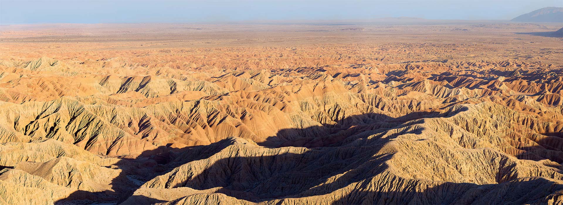
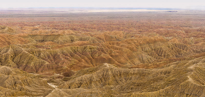
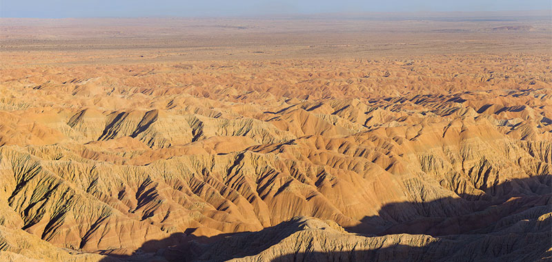
13 Apr Font’s Point Overlook of the Borrego Badlands
Anza Borrego Desert State Park, California
In 1774 the Spanish explorer Juan Baustista de Anza passed by this spot and noted what would one day be known as the Borrego Badlands. The view from this headland was described by his official chaplain, Father Pedro Font, as “the sweepings of the earth.”
Here four million years of the earth’s history are dramatically spread out in front of you. Font’s Point is one of the best places in North America to note the passing of geological time; what is now an intricately-sculpted maze of conglomerates, sandstone, and clay was once a warm and abundant basin of the Gulf of California, the meeting spot of the Colorado River and the sea.
Each of the gigapixel panoramas below is composed of some 400 individual images. To explore the scenes in detail, click the full screen button at the right of the toolbar, and then zoom in by clicking in the image, or by using the buttons provided. The first image was made March 21, 2016, 3:15–4:00 PM. The sunset panorama was shot March 26, 2016, 5:45–6:30 PM.
The turnoff to the five miles of rough and sandy 4WD road up the wash to Font’s Point is about ten miles east of Borrego Springs on Palm Canyon Drive (S22), at mile marker 29.3. You can see a satellite view here.
No Comments